Country Information
South Africa (officially: English: Republic of South Africa; Afrikaans: Republiek van Suid-Afrika) is a republic in the south of the African continent. The total area of the country is 1,123,226 km², excluding the “independent” homelands of Bophuthatswana, Ciskei, Transkei and Venda, and Walvis Bay; including these areas: 1,225,765 km². South Africa is therefore 30 times larger than the Netherlands. The coastline has a total length of 3,000 kilometres.
South Africa borders Swaziland to the east (430 kilometres), Mozambique to the northeast (491 km), Zimbabwe (225 km) and Botswana (1840 km) to the north, and Namibia to the northwest (855 km).
Read More...
Entirely enclosed by South Africa as an enclave, lies the mountainous state of Lesotho (total border length 909 km). In 1947, the (then) Union of South Africa formally took possession of the uninhabited Prince Edward Island and Marion Island off the coast of Cape Town. Other well-known islands off the coast include Santa Cruz near Port Elizabeth and Robben Island near Cape Town.
South Africa also borders the Atlantic Ocean to the west and the Indian Ocean to the east. The distance from the Limpopo River in the north to Cape Agulhas in the south is approximately 2,000 kilometres. The distance from Port Nolloth in the west to Durban in the east is approximately 1,500 kilometres.
The most important river in South Africa is the Orange River, which rises in the Drakensberg mountains of KwaZulu-Natal and flows for over 2,200 kilometres into the Atlantic Ocean near Oranjemund and Alexander Bay. Other important rivers include the Vaal, the Limpopo, the Great Fish River, and the Tugela. Most of these rivers are barely navigable.
The landscape of South Africa is very diverse and can be divided into 21 natural regions. The Lesotho Highlands form the highest part of Southern Africa and form the border between Lesotho and South Africa. The highest peaks rise above 3400 metres and snow often falls on the mountain tundras in winter.
The Hoogveld is a gently rolling, high-lying area and consists mainly of savannas. The urbanised Witwatersrand also lies here, surrounding important gold and coal mines in South Africa. A lot of maize is also grown here.
North Transvaal features diverse landscapes, including the Soutpansberg mountain ranges and the Waterberg plateau, with the Pietersburg Plain situated between them, where cattle farming is significant. The Soutpansberg is an important forestry area.
In the north of the Cape Province lies the Ghaap Plateau, where the semi-arid climate only allows for livestock farming.
The flat and extensive Bushman's Flats on the interior plateau also lie in the northern Cape Province and are covered only by sparse scrub and suitable only for extensive sheep farming. Striking are the many “pans”, small lakes that are only filled with water for part of the year.
To the north and west of Pretoria lies the Bushveld Basin. In the flat, central part of the basin, many minerals and precious metals such as platinum, vanadium and chromium are found. The clayey black turf soil is extremely fertile and is therefore where many crops are grown.
The flat, sandy Kalahari Basin is a semi-arid savannah, primarily covered in acacia trees. This area was once characterised by desert dunes, only a few of which remain.
In the northern Cape Province lie the valleys of the Lower Vaal and the Orange River, two of South Africa's major rivers. The valleys are situated in highly developed areas, including a gigantic irrigation project (Vaalharts) on the Harts River, a tributary. Between the two valleys lies Kimberley, the centre of the diamond mining industry.
The Karoo is a vast semi-arid plain with flat-topped hills covered in grass and scrub. The highest points on the plateau are Giants Castle (3820 m), Cathkin Peak (3650 m) and Mont aux Sources (3299 m) in the Drakensberg mountains. Only sheep farming is possible here.
The Transvaal Drakensberg is covered with forests due to sufficient rainfall and is a resort where many tourists stay for, among other things, hiking. The Transvaal Drakensberg is part of the Great Escarpment.
The Natal Drakensberg is also part of the Great Escarpment with peaks above 3000 metres. Mountain sports take place here.
The Cape Fold Mountains, covered in a unique vegetation called “fynbos” or maquis, consist of a series of mountain ranges. Mountaineering is also very popular here. In the valleys between the mountain ranges are centres for fruit cultivation and viticulture. The coastal regions have beautiful beaches and deep bays. The only more enclosed bay is Saldanha Bay on the west coast.
The Namaqualand Highlands consist of dry, rocky mountains where, if there is enough rain, a great many wildflowers grow. The area bordering Namibia is the Richtersveld.
The Limpopo River forms the border between South Africa and Zimbabwe. The river flows into the Limpopo Valley, a dry savannah region with open woodland where a lot of cattle are kept and where there are many wildlife parks.
The undulating landscape of the Lowveld lies between the foothills of the Great Escarpment and the Lebombo Mountains in Swaziland, Northern Natal and the Transvaal. The hot tropical climate in summer makes it possible to cultivate tropical fruit here. This is also where South Africa's largest reserve, the Kruger National Park, with its forests and savannas, is located.
The South-East Coast Hinterland is an area of rolling hills and deep river valleys. It stretches from Swaziland to the former Ciskei in the south. There is heavy rainfall, which is drained by numerous rivers into the Indian Ocean.
The Lebombo Mountains lie on the border of South Africa and Mozambique, in the Eastern Transvaal, Swaziland and northern KwaZulu/Natal. This mountain range is characterised by deep gorges through which rivers flow to the Indian Ocean.
In northern KwaZulu/Natal lies the Zululand coastal plain, overgrown sandy plains with bush. Many lakes and river mouths are also found here. Numerous animal species live in various nature reserves.
The Southern Cape Plateau stretches from the southernmost point of Africa up to Port Elizabeth. Beautiful forests and lagoons can also be found here.
The rolling plain between the Atlantic Ocean and the Cape Fold Mountains is the Swartland. A lot of grain is grown here.
The Namib is a desert and the Benguela Current flows along its coasts. The coastal waters are very important for South Africa's fishing industry. Furthermore, it is an inhospitable area.
Holidays and Sightseeing
The tourism industry is of increasing importance to the South African economy. Millions of foreigners visit South Africa every year. That number could be many times larger, but for now, there is a lack of sufficient facilities to receive many more tourists. Most visitors come from Africa, but the number of visitors from outside Africa is increasing very rapidly. In 1995, approximately 50,000 Dutch tourists visited South Africa. This number grows annually.
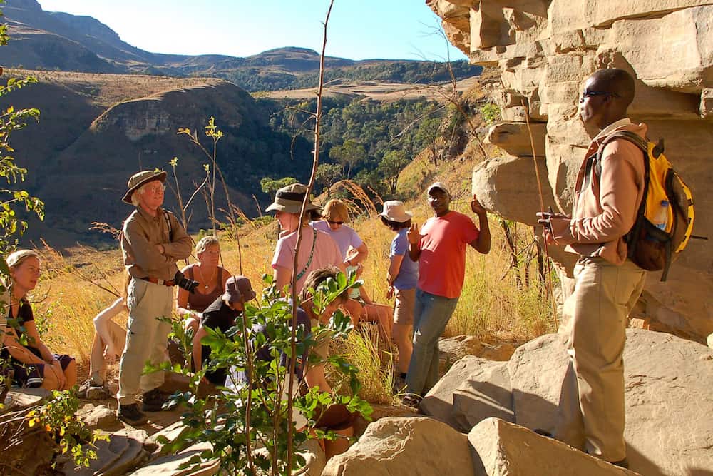
One of the biggest attractions in South Africa is Kruger Park. This is a large wildlife park in the northeast of South Africa, on the border with Zimbabwe and Mozambique. There are many species of animals to be spotted. The most well-known are the Big Five. These refer to the lion, rhinoceros, buffalo, leopard, and African elephant. Another attraction is the Drakensberg mountains. This is a mountain range with a lot of natural beauty, which is gaining more and more tourist interest.
Johannesburg, with the well-known Soweto, has become one of South Africa's most popular tourist destinations. Some of the main attractions in Johannesburg include:
• Lesedi Cultural Village
• James Hall Transport Museum
• AECI Dynamite Factory Museum
• Florence Bloom Bird Sanctuary
• South African National Museum of Military History
• Witwatersrand Botanical Gardens
Historical museums, such as the Apartheid Museum and the Hector Pieterson Museum, attract tourists from all over the world. The city also has several art museums, including the Johannesburg Art Gallery, which houses many South African and European landscape and figurative paintings, and the Africana Museum, which chronicles the history of the city of Johannesburg.
Cape Town, with Table Mountain and a vibrant centre, is also definitely worth a visit.
The Groote Kerk is probably the most famous church in South Africa. The church was built in the 19th century on the site of an earlier Dutch Reformed Church. The Groote Kerk has a number of particularly interesting sights, such as the lockable pews, the enormous pulpit, the organ with 6,000 pipes, and an unusual soapstone floor, beneath which around 200 people are buried.
The revamped Victoria and Albert Waterfront is now a vibrant cultural and recreational centre.
Table Mountain is Cape Town's most visited attraction. A cable car (funicular) takes visitors to the summit at 1085 metres in just six minutes. Once there, on a clear day, you can see spectacular panoramic views that leave a lasting impression. The more adventurous can follow various paths that traverse the mountain, enjoying even more beautiful views of the city and the ocean.
Robben Island is part of UNESCO World Heritage and is accessible by a short ferry trip across Table Bay. The most famous prisoner of this notorious jail was, of course, Nelson Mandela. Tours of the prison are given by former political prisoners.
Climate and Weather
Due to its location south of the equator, the South African summer begins in December and winter in June.
Despite the country's enormous size, the climate is relatively uniform and temperate. This is particularly true for the temperature inland, which is a consequence of the fact that at lower latitudes, the altitude is generally greater than further south. Typically, the average temperature in Cape Town is 16.5°C, and in Johannesburg, located much further north, it is 16.2°C.
It is warmest on the east coast with an average temperature of 20.6°C in Durban. During the day in Durban, it averages 27°C in summer and 22°C in winter. The temperature on the west coast is kept uniformly low by the cold Benguela Current, while the temperature on the east coast is kept uniformly high by the warm Agulhas Current.
The warmest month inland is January, and the warmest month on the coast is February. Even in winter, it's usually around 20°C in most places. In the north, October and November are warm months due to the summer rains. In the higher inland areas, it freezes regularly, and in the mountainous southeast, it even freezes on more than 100 nights a year. Due to the average low humidity, there is often no more than a thin layer of snow.
In two-thirds of South Africa, less than 500 mm of precipitation falls per year. Most precipitation in South Africa falls during the summer, as moist air from the Indian Ocean flows inland with force. In Cape Town, however, most precipitation falls between June and September. The rain in summer often falls in short, heavy showers after which the sun quickly shines again.
To the west of the eastern mountain ranges, rainfall is at its lowest, while the rest of the country generally receives a consistent amount of precipitation, around 1000 mm per year. Except for the southern part of the country, where the influence of weather fronts means most rainfall occurs in winter and a temperate rainy climate prevails. The east coast in the south experiences dry winters. Towards the west, it becomes progressively drier, and the central part even has a steppe climate with approximately 100 mm per year in the Kalahari Desert. In cities such as Bloemfontein and Kimberley in the central part of South Africa, temperatures easily reach 30°C in January and February.
The number of sunshine hours is very high, for instance compared to the Iberian Peninsula. In Madrid, the sun shines for an average of 2910 hours per year and in Lisbon for 2740 hours. In South Africa, Cape Town has an average of 2980 hours and Pretoria 3240 hours per year. Coastal towns of the Cape Province and KwaZulu/Natal receive on average 300 sunshine hours more than the Canary Islands.
Source: landenweb.nl